The Dempster Highway
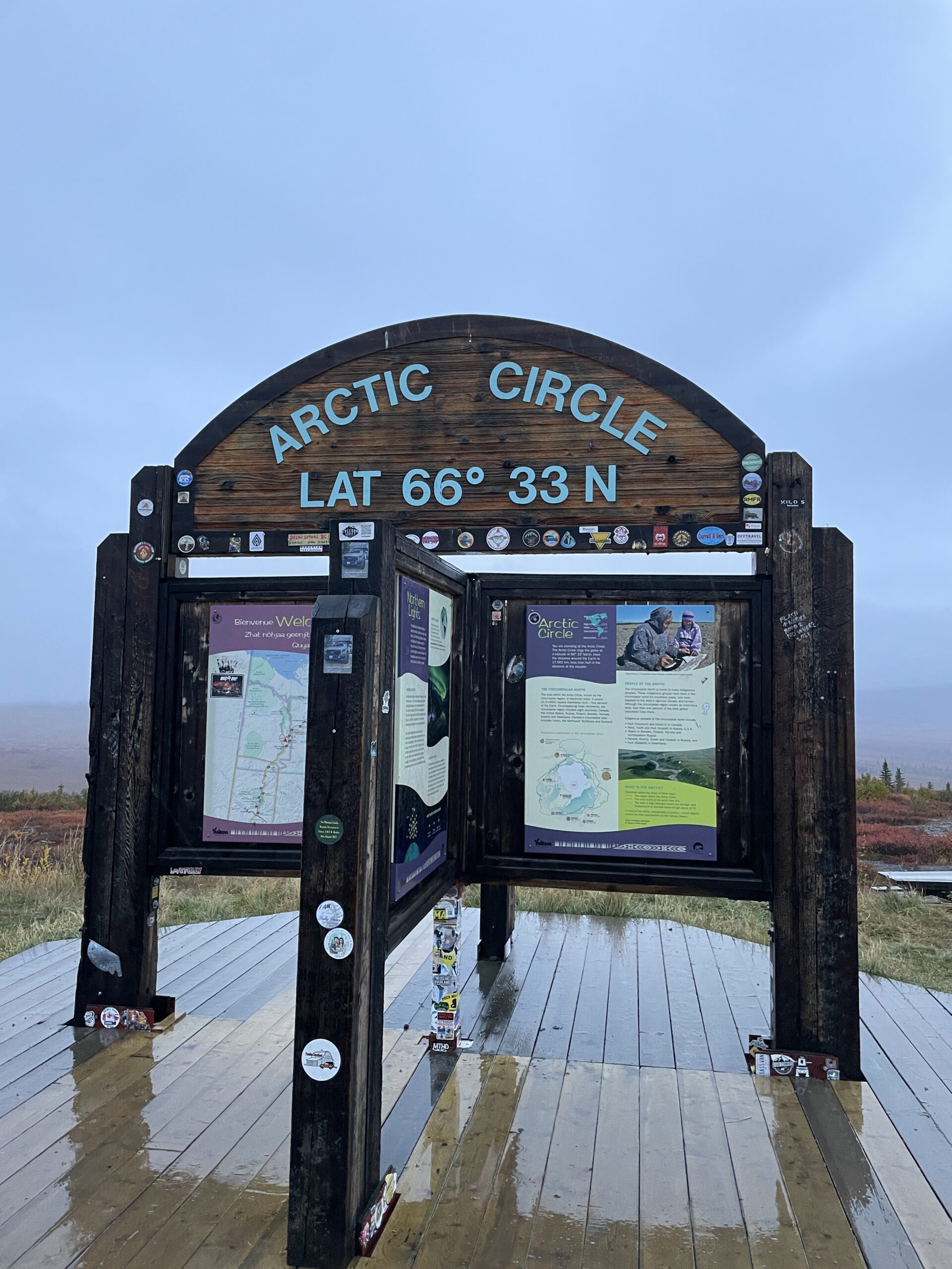
A dirt road, a thousand kilometers long. It sits on top solid frozen permafrost, ending at the Arctic Ocean. Two gas stops, 600 kilometers apart. Halfway through, you cross the Arctic circle. Two river crossings, which are frozen eight months of the year—when frozen you just drive over the river.
In rain or snow (both happen depending on the time of day) the road transforms from a sharp rock studded horror to a horror of slick flat mud, hiding potholes that can swallow a small car, or the better part of a big one.
Fogs, thick as a bedsheet, rise and fall with the road as it winds through mountains, alternately beautiful in sunshine, then wet and greasy, dark and ominous in sleet. Freshly graveled, the road is covered in sharp shale stones; like driving over a blanket of prehistoric flints, each waiting to pierce the tires that disturb their rest. Not freshly graveled, it becomes shiny and slippery like a sheet of polished, oiled steel. The one gas station along the way capable of repairing a tire posts the mechanic’s availability. If he’s not there, then you wait, you’re not going anywhere.
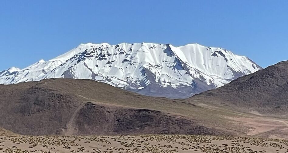
This road rides atop the grandest wilderness on earth, a sheet of wilderness, undulating, rocky, colorful, lovely and rugged, unabated to the east until you reach the Atlantic Ocean, 4,000 kilometers away, including an arc of 1000 kilometers across the cold waters of Hudson Bay. There is scarce chance you’ll encounter a human, unless a wandering Inuit, and no chance you’ll encounter any settlement. Instead, mile upon mile of arctic forest, tamaracks and larches. The tundra lies spongy and low underfoot, like walking on a mattress, pocked with uncountable lakes. After crossing a full continent, you gaze out on the frigid North Atlantic.
If you can picture all that, then you have an idea of what the Dempster Highway is.
Sitting in Calgary the year before around a friend’s kitchen table, we nursed our drinks, talking of this and that. “I’m driving up the Dempster Highway,” he casually dropped, knowing this would inflame my interest at once. Or maybe not knowing–me, who obsessed over the Arctic since my mid-twenties, who devoured every book on the Inuit and their way of life, who eagerly read Farley Mowat’s fanciful descriptions of the Barrens when I was 12.. I sprang on him at once with a barrage of questions. With who? How? Surely not in your own truck, something quite unsuited to such a trek.
The story came out–an acquaintance, long an adventurer, had broached the idea. He had gone to the extent of buying a rugged truck capable of the journey, had created an elaborate plan with mileages, stops. He had asked him to accompany him, and my friend had not demurred.
Now it was fall. The trip was off. For his own personal reasons, his friend had packed up, sold his truck, and moved to the west coast. I called him and said, “Let’s go anyway. I’ll go with you.”
“We don’t have a truck.”
“Leave that to me,” I said. “If there’s one thing I’m good at, it’s travel logistics.”
“Well, we’ve already got the plan. There’s only one road.”
And that is how we found ourselves in Whitehorse a year later.
Whitehorse
Right away, it was the fresh air that struck me. Cool, fragrant with a, I don’t know, wild kind of scent, the smell of the land, blowing freely. The World Health Organization had taken notice as well. In 2011 they ranked Whitehorse the city with “the cleanest air in the world.” However, Whitehorse residents are not ones to rest on their laurels. In 2019, assiduously, they surveyed its residents, 60% of whom use wood stoves to heat their homes, asking them about air quality. The residents were far more exigent than the WHO, suggesting various means of making their air yet cleaner–from subsidizing dry wood to using wood pellets rather than firewood.
The far north is like that–living close to and off the land, harvesting firewood, but also united in the knowledge that they are a community that is up against the harshest conditions of nature. And of course, there’s a government study. The government employs over 30% of Yukon residents.
They don’t have a choice. A city at 60 degrees north latitude does not have many advantages. It is far from the population centers further — much further, south. The sun barely rises for four months of the year, and temperatures reach a high—high that is, of -10C in January.
Despite this, almost disarmingly, a walk down Whitehorse streets leaves you thinking you could be in any Canadian city–the same familiar banks, the same traffic lights, the federal Canadian buildings, the post office, and wide, windy streets. Whitehorse has a government feel to it. It is the capital of the Yukon, a province with barely forty thousand people, spread over a half million square kilometers of land. Prominent buildings, the biggest and newest ones, sport a large “Canada” sign. But below the bland government placidness of the government town lies a rollicking Yukon that you do not have to go far to feel the current, brisk as the Yukon River itself.
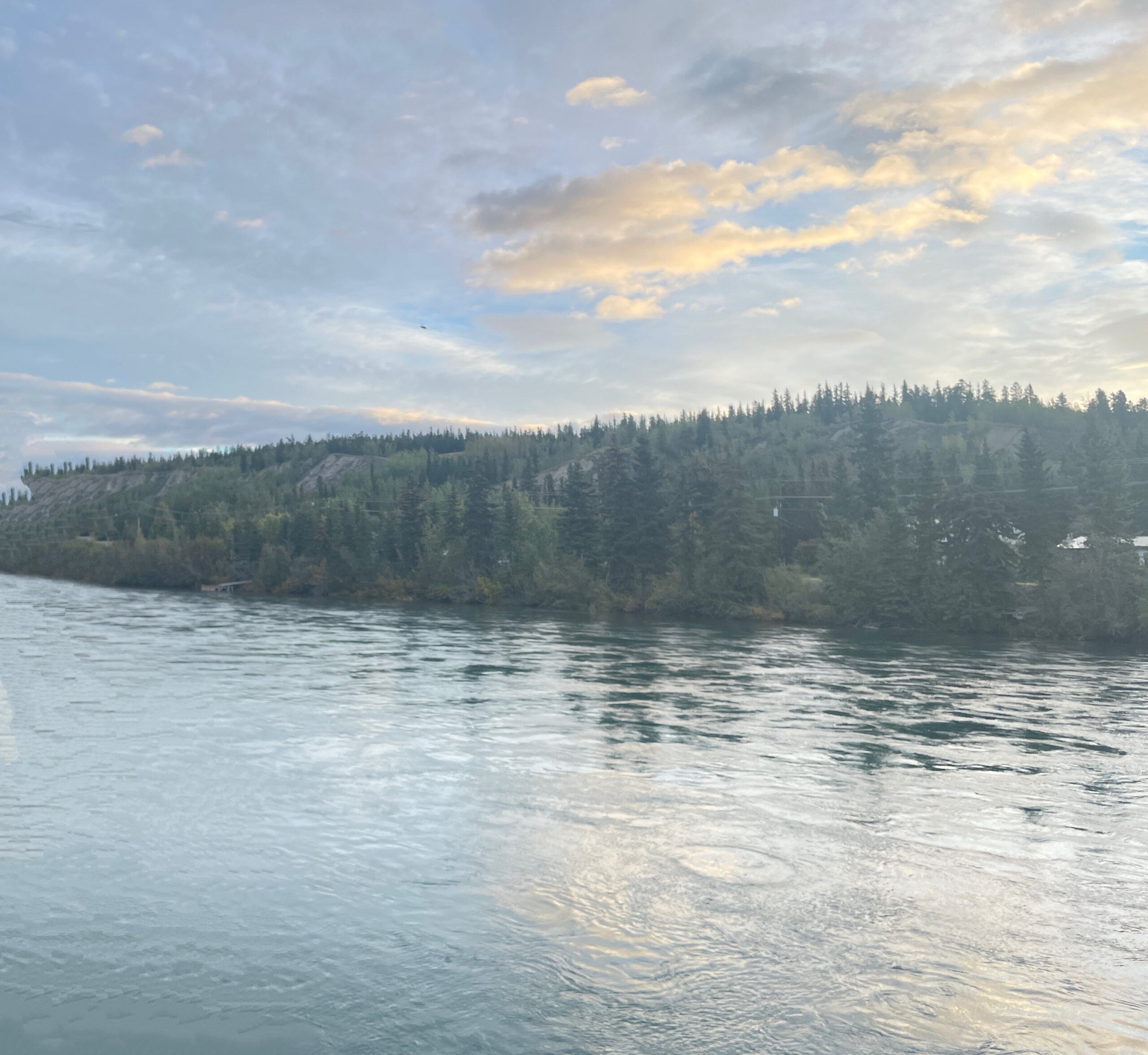
The Yukon River runs through Whitehorse, a rather intimidating cataract, fast running, deep, cold, unfit for swimming or any other recreations except for the hardiest. It is among the largest rivers in North America, coursing 3,000 km before draining into the Bering Sea. It lies below a high scarp, atop which the airport is situated, through an ancient lakebed from the last ice age, when this area was a huge lake. Rust-colored argolite fills hilltops results over the city. In fact, glaciation feels like it is more recent here–the land has a certain rawness that agriculture and milder weather have erased in the south. Here, glaciation seems like it happened the other day.
You also get a sense of simmering vitality beneath the bland exterior. There are rough-edged bars interspersed among the government blocks, best appreciated at the Kopper King bar. There, in the worn dark wood bar and restaurant, dozens of men and women, all dressed in plaid jackets, many old timers, are making their way through a lot of beer. Similar bars dot downtown, and to quote the Stan Rogers song, many had “a winter’s thirst to drown.” Could that explain the oversized courthouse?
Like all the north, Whitehorse is a mix of native peoples–these spanning 14 groups and 8 languages, old-time Yukon residents, and now, fresh new immigrants from across the world.
The taxi driver from the airport was a middle-aged Somalian lady, but she spoke like an old northern hand.
“You’re staying at Canada’s Best Value Hotel?” she laughed. “It’s the worst hotel in town.”
Every hotel we stayed at, however, looked the same—as though they were last remodeled, collectively, in 1975. Dark wood, worn carpets, loose, cheap fixtures and yellowed tubs.
But everything that makes up a hotel, every piece of wood, every tile of flooring, every tap, every stick of furniture must come from the south. You have a choice—groceries, fuel and medications, or a replacement sink.
At least the hotel receptionist (from India) understood at once why one would need a good kettle for tea and rustled a dusty, battered one up for us.
The first meal we ate was broiled muskox and wild berries. No, actually, it was Korean pork ramen, authentic and well made at Wood St. Ramen on the main street.
“Our first meal in the Yukon is Korean,” I said.
The owner overheard me and laughed, “That’s the Yukon.”
Today, except for the First Nations that have lived here since the ice corridor opened 12,000 years ago, it is a place for people from somewhere else.
Some have cruelly commented that the major industries of the Yukon are government subsidies and snowmobiling. And it is true that without the infusion of Federal funds, the Yukon we know would not exist. It would be a smaller community of subsistence workers, living off furs, small gold mines, and working for mining companies that come and go.
Every view, every aspect of Whitehorse gives one the feeling that it is a city with the wilderness lapping up against it, from the first view of the city from the air, with the magnificent, icy, truculent Lake Laberge just north of it, to the fast running Yukon river, to the raw landscape of the escarpment beside it. Leaving Vancouver by air to fly here, within a short thirty minutes there were no signs of humans in the wilderness below. Unvisited snowfields, magnificent hanging glaciers, isolated mountain tarns, impossibly blue slowly passed under us for three hours, until we saw the first signs of Whitehorse.
Landing in Whitehorse, I was delighted. I kept grinning superciliously, saying to myself, “Whitehorse! The Yukon! I’m actually here!” It was a dream come true. There was a long wait for luggage and I felt like I was waiting for baggage in Mumbai off a Canadian flight—large, overstuffed suitcases, boxes wrapped in multiple layers of packing tape – it’s clear the trip to Vancouver was a provisioning one.
I don’t know how many tourists Whitehorse gets. The charms of the city are quickly exhausted, not because there aren’t things to see. The First Nations Museum, the Jack London museum are well worth a visit, but the traveler has likely wound up in Whitehorse not as a destination, but because they have touched down at the airport, connecting this corner of Canada to rest of the world, and is headed north into the wilderness, the tundra, the mountains and the high Arctic.
We were no different. We obtained our truck, a well-outfitted Ford F-150 with a high suspension, rugged tires, flashing lights, two spare tires, spare gas, and a satellite phone, hired from K&K Truck Rentals. A stringy young man, Tyrone, with a wispy mustache, delivered it. He was the sort of kid that’s hired to hand over the keys as his sole task, but he turned out to be knowledgeable about the truck, its capability, and the road ahead.
“You’ll have no issue with gas. This thing goes 1000 km on a tank. Take it easy on the Dempster. The potholes can swallow a car.”
His last comment was a favorite among Yukoners—everyone we met repeated it about the Dempster.
Canada’s Best Value Hotel seems to attract the itinerant (and economy minded) adventurer. There was a German lady in her late 60s who had shipped her camper around the world. It was lettered on the outside with all the places she had visited across several continents.
She lost her husband in Kenya. Not lost him but lost him as a traveler and husband.
“He hooked up with a 23-year-old and stayed there. They’re married and have a baby son.”
We couldn’t tell if she was angry or glad to be rid of him.
“Well, he’s probably up overnight with a baby at 70 years of age,” I said, I thought helpfully.
“No, he doesn’t lift a finger. She and her family treat him like a king.”
Maybe it was anger after all.
I asked if I could peek into her vehicle. It was narrow and close, kind of like the pictures you see of the inside of the International Space Station, or maybe a WW2 submarine. It was dark and dank. I suppose the he wasn’t the first to have jumped an unpleasant ship for a maiden on the shore.
We were headed to Tuktoyaktuk, on the Beaufort Sea, 1400 km away over the famed, rugged Dempster Highway. Leaving the hotel, the backup siren came on and people stopped to look at us. We were departing on a serious journey! Or at least that’s how we felt.
Pausing to stock up on the kind of groceries that travel well–coffee, nuts, peanut butter, bagels, powdered milk, apples, a gas canister to make coffee on our camp stove, we fueled up the truck, which held, at northern prices, $200 worth of gas and headed confidently out of town toward Dawson City.
“No need to navigate,” we told each other. “There’s only one road.”
That is, until 45 minutes later, when we realized there were two roads–the Alaska Highway, going to Haines, Alaska, and the Klondike Highway, which we had missed, going to Dawson City.
Oh well, we were off to a good start.
Dawson City
If you think Dawson City is a still rollicking town of gold prospectors, dirt roads among colorful clapboard hotels, restaurants and bars, alongside streams where hopefuls pan to find nuggets of gold dust and use it to pay hotels bills … you’d be right.
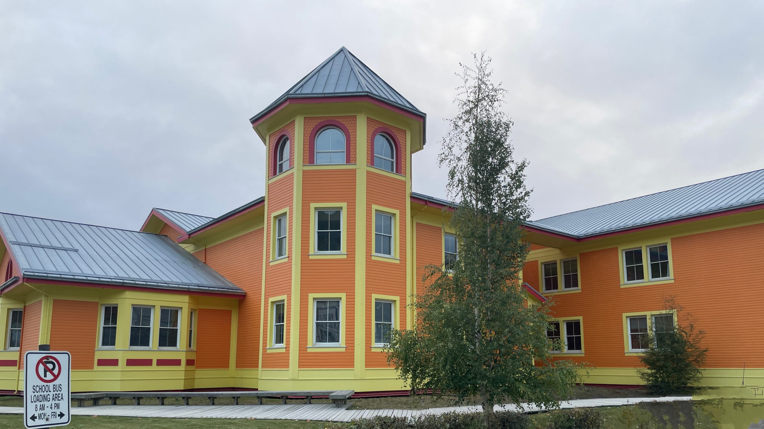
The town feels like a set piece from an 1890s Klondike gold rush film. Our hotel was purple and white clapboard. The combination of the Robert Service school, city hall and community center was a bright mélange of carmine, pumpkin orange and yellow, as though colored with children’s’ crayons. In fact, it was—the children were asked what color they wanted their school, and the civic fathers indulged them.
The first night in Dawson we found ourselves in the comfortable bar at the Triple J hotel. It was homey, with the ever present dark wood paneling and worn furniture. Our amble there took us across the elevated wooden sidewalks, raised above the packed dirt streets, from (of course) The Eldorado hotel.


First, we quizzed the waitress on life in Dawson, especially in the eternal darkness of winter. She told us it wasn’t too bad. Well, on second thought, yes, it was. People drank a lot. She said it wasn’t the cold so much as the light. In fact, with all the tourists gone, the town became like one big family home. Everyone knew each other, and they had no choice but to spend it in each other’s company.
“Yeah,” she said. “Sometimes that’s not so good either.”
Two old fellows sidled up to the bar. Both were old, sporting bushy gray beards, tinged brown with nicotine, wearing rough wool coats.
“They look like old, grizzled prospectors,” I said to my friend.
After they’d ordered, one specifying a red wine, Shiraz please, the other a rye and ginger, I asked, “So what brings you guys to town?”
“Oh, we’re prospectors. We’re looking for gold.”
Of course.
“Really? People still make a living doing that?”
“Yup.”
“So you pan in streams?”
“No, we go up into the hills looking for lode veins.”
Since everyone in town seems to be an expert on gold, we had learned that the Klondike gold rush of the late 1800s was in search of “placer” or “alluvial” gold found by panning or dredging streams. Families have trucks, excavators, and stake a claim still do this kind of mining.
When asked if they make money at it, I was told, “They’re driving nice trucks around town.”
Panning for gold is small potatoes, but it still yields daily results. Today, miners find almost no nuggets, only dust. Mechanized techniques (not hand panning) process 100 cubic yards of gravel to produce roughly an ounce of gold dust. The purity is 70-80% gold or 18-21 karat depending on the river. Put another way, it takes 8 or more dump trucks gravel to yield a single teaspoon of dust, which looks more like ochre earth or brass, than gold.
These two old prospectors were after different game. Placer gold in streams is in fact a tiny fraction of gold in the surrounding terrain, like stray coins that have eroded away from the main treasure chest. Follow the stream and you discover the “lode,” the source of it all, concentrated in a vein that holds millions of ounces. Low odds and high gain.
I asked the prospectors about their chances—panning in streams already seems low, but looking across millions of square kilometers of remote wilderness for a vein seems even more remote.
They were cagey. Like the gold rush days, people are very reticent to talk about yields, or locations, or anything else that might give away their stake. Some things haven’t changed since the 1890s.
“Yeah, we have to know where to go, stake a claim, and do a lot of digging. It’s cold and dark, but winter time is better because the hole doesn’t cave in. We dig a deep hole and go down to take samples.”
They used candles instead of electric light—the locations are too remote and batteries don’t last in the frigid cold. Once, the candles kept going out and he yelled up to his companion.
“Don’t buy those Walmart candles no more. They don’t stay lit.”
Until they found out that they were in fact running short of oxygen down the hole after he felt dizzy. The Walmart candle turned out to be the canary in the coalmine.
If you think your job is unpleasant, think about being down a wet, muddy hole in sub-freezing temperatures with only a candle for light, searching for something that you have a less than one in thousand chance of finding. It matters little if it’s day or night—it is always dark 24 hours a day.
But they did it willingly – gold, glittering gold, holds a lock over human desire the centuries over.

The Dempster
The Dempster is 740 km long, stretching across the Yukon and the Northwest Territories from just east of Dawson City to Inuvik, crossing the Arctic Circle on the way. We started on a rainy morning after refueling.
Is the Dempster Highway a road, a village or a concept?
While driving it, we felt a strange sense of being not on a road from one place to another, but a kind of town square. Can a town square be a thousand kilometers long and 15 meters wide? News travels up and down the Dempster in a flash. A fearsome pothole at kilometer 480. A slippery bridge. Whether the mechanic is in Eagle Plains that day. When the next diesel supply is arriving, or the grocery truck. The stage of freeze up at the Mackenzie River crossing.
The nerve center of all this is at Eagle Plains, at kilometer 371 and just south of the Arctic Circle. This is the only midpoint stop for gas, food and lodging. It runs self sufficiently on diesel generators running nonstop. Everything, the water, heat, lights, cooking, satellite internet, pumps for gasoline depends on it. If the generator goes down, Eagle Plains goes dark and cold.

Trucks and traffic going north and south stop and cross here. A helicopter might sit in the parking lot. A colorful cast of people: beards, mustaches—prospectors. A white-haired man with two bleached blondes, loudly drinking beer. A clean cut Japanese man, in a Patagonia vest.
A stray Inuit trapper is sitting on the couch in the lobby. He sits for hours, merely smiling and nodding at everyone coming and going. In my reading, I had encountered accounts of old Hudson’s Bay posts where Inuit would gather, largely in silence, smiling, sitting for hours and accepting the occasional cup of tea. No one bothered this fellow, and he gave us the most congenial of smiles when we walked by, no matter how many times.
Dogs wander in and out of the dining room and bar, richly decorated with muskox and moose heads, and the entire pelts of bears, caribou, beavers. It is a comfortable and cozy place against the wildness just outside the door. There is hot water, showers, internet. A friendly dinner—simple of course, pasta or burgers or sandwiches plus a welcome glass of beer or red wine. It is abuzz with travelers coming and going – a crossroads. At the door, visitors take off their tall muddy boots, as though they were entering someone’s home. And indeed, it is their home, because in a few days’ time they’ll be back, having traversed 1500 kilometers of highway. Eagle Plains gives these “residents” of the Dempster village special treatment, unlike us. The restaurant is open early and late, but only to them. They take an early morning coffee before setting out, chatting with the staff. I once intruded on this to get some hot water and got a frosty stare.
The owner of this lively establishment was a well-spoken, polite man, the owner—thin, somewhat scruffy in the Northern style, apparently casual, but with the sharp eyes of a proprietor, scanning the room, dressed in a tan and brown flannel mackinaw. I sat with him at the dark wooden bar, polished from fifty years of use. Alternately stroking the passing dogs, we talked about the difficulties of getting staff to work at the Inn. He told me that the prime minister’s current policy of restricting immigrant workers would severely hurt his business. Canadians have no taste for working in the far north it seems, only immigrants will accept the work. Presumably ones that don’t mind -40 weather and no sunlight for 5 months of the year.
As my companion said, “It takes a special type of person.”
The bar tender, (from Australia) advised me on the best wine to drink, a Shiraz from Australia, confiding to me the rest were cheap but undrinkable. Long accustomed to the owner’s habits, he fed him Coors Lites at the rate of one every five or six minutes. One was barely finished before the bartender, wordlessly, uncapped another and slid it toward him. It was a well-rehearsed game. During our half hour conversation, he had six.
“It was a pleasure to speak with you,” I told him.
“No,” he said, rising, “The pleasure was mine.” With both his hands, he grasped mine. It was as though he was grateful for a conversation, or perhaps because he was one of those natural gentlemen that one encounters rarely. Then he sat down to a newly opened beer.
Overnight the fog descended, and through it the orange lights of the big diesels, growling in the parking lot, glowed fuzzily. The air held the wide scents of cedar and fir, the chilly fog dampening your skin, the road slippery. We set off, eyes peering anxiously into the windshield haze, hoping to glimpse the road, and getting occasional flashes of silver, the deadly potholes. A moose cow and her three calves crossed the road. She paused and then headed off the road. The youngsters, curious, stopped to look at us and then hurried after their mother into the tundra mist.
Is the Dempster a concept? The original conception of the Dempster was a commercial one—oil and gas in the Mackenzie River delta. That didn’t materialize, and instead it became a supply link to Inuvik, the largest town in the Canadian Arctic, and the only one in North America that has a road link to the Arctic Ocean. Now it is a symbol of Canadian sovereignty in the Arctic. To prove it, there are permanent residents all the way to Tuktoyaktuk, on the Northwest Passage. The US spends even more in Alaska, primarily through stationing large numbers of military personnel there.
These days, Canada is confused. Is it the Russians or the Americans that are the threat? In the past, when it was clearer, Inuvik was a joint US and Canada air base. Now the United States and Russia have both claimed the Passage is theirs, or in international waters. Frozen for eons, it is now navigable and a sea route from western to eastern Russia. “Look Canada,” they seem to say, “you don’t have anyone living there, it’s wilderness.” Except there are communities. Federally supported Fort MacPherson, Tsigehtchic, Alklavik and Tuktoyaktuk.
Living in the Arctic is not a simple proposition, and these communities float on a sea of Federal money. Handsome large schools and groceries helicoptered in when the rivers are uncrossable twice a year. Those “nice” trucks, the universal currency of success in the north are not the industrious fruits of the land, but the end of the pipe of funding from Ottawa.
Canadian are fond of “competitive” weather talk. A Torontonian calls minus 10 degrees chilly. “Oh yeah?” said the Thunder Bay resident, “we don’t put our coats on until it’s twenty five below.” The Winnipegger pipes up, “you wear coats? We change out of our shorts at minus thirty.”
Similarly, Yukoners fall over themselves to expound on how bad the Dempster is. The favorite is “potholes that can swallow a car,” but the “gravel that slices tires to shreds,” is a close second.
In fact, the Dempster is not a road at all; it is a monster, 800 kilometers long, that lies smooth and unruffled on some days. But anything can provoke it, and when aroused it has all sorts of ugly tricks. In the wet, the mud forms a sucking sort of slime that reaches out and grabs your tires. A little silver skim of water cleverly conceals the potholes; it looks like a puddle but is three feet deep. Shale gravel waits, its scythe like edges waiting to slice your tires into ribbons. A rime of frost forms with no signs as you rise in elevation, and sends you skittering off the road. Guardrails are for us southerners–the Dempster has no such things. Here you careen off and over the hill or sink into the muskeg.
Sometimes my companion would shriek out words which are best not repeated here when the road wrenched the wheel from him, like some unseen force. But it was just the Dempster, raised from its placid state to an angry one, declaring grinningly that it never guaranteed a safe and quiet passage.
But it was engaging driving such a road, man against road, a kind of continuous video game of challenges and entertainments. It made you keep your wits about you. We drove with two sets of eyes fixed on the road ahead, calling out any hazards, real or imagined. On the upbound trip we had hunched shoulders, stiff necks. On the downbound, however, we had struck on a formula—only 90 minutes before changing drivers and a quick breath of the bracing air. We relaxed as we read the moods of the monster better.
I miss is still, that ever changing road, through the wildest terrain on earth. Our own paved highways are dull, repetitive and boring, if safer.
The second hazard was ourselves. It can be taxing to travel with another person for every meal, hotel, and moment on the long stretches of road. I was worried about it before the trip. Would I find my companion tiresome? There was no way to bail out halfway. And while all travelers have their individual foibles, we conversed pleasantly on many topics, made our coffee together off the tailgate of our truck at stops and dined congenially together. My companion was a dedicated amateur philosopher, and an academic, so I was the recipient of much of his reading. In this way we passed the time pleasantly.
Whenever some obstacle confronted us, we both decided to be untroubled by it. After all, while the circumstance may be forced on us, being troubled is a decision. I related my readings about the Inuit when they encountered difficulties on the trail. “Nothing can be done,” they sigh and go on. It became our motto as well.
Not everyone takes this advice. Construction delays on the way to the Dempster backed us up, where an older man, in jeans and a jacket, with a full head of white hair, became agitated, got out of his truck, ran wildly forward to see what was happening, then ran back to his truck, and then, for his own reasons, ran forward again.
My companion remarked, “You don’t usually see a guy that old running that hard.”
“Nothing can be done,” I said.
Is the Dempster a road? This is not as foolish a question as it might seem. I’m sure you’ve been on dirt roads before. What you see is pretty much the whole thing—a path scraped out of the dirt. Not so with the Dempster. The “road” is in fact dug to a depth of a minimum of four feet, but as much as eight feet, then filled in multiple layers. It sits on permafrost, so if this insulating layer were not there, the entire road would sink from the heat gathered by the roadway above. The bridges posed a challenge. The same engineers who would later assemble it on-site constructed and mock-assembled the steel Eagle River bridge in Hamilton, Ontario, to prevent on-site alterations.
The road is in a perpetual state of maintenance, with new gravel and grading incessantly carried on. The work is carried on with more (in the Northwest Territories) or less (the Yukon) urgency. But without it, within weeks, the great semi-trucks could not pass over the road. It is a living highway, better termed a system, than a road.
But let us forget the politics, the engineering, the people. The Dempster is a little strip of civilization through some of the most breath catching scenery in the world. It is wild, unforgettable, rugged and at once serene. We went in the fall and saw a glorious ribbon of color, and hills that looked as though someone had splashed them with colored chalk. The reds, the yellows, and the black rocks were vivid in sunshine but deep and rich—saffron and ochre, when overcast.


There were long lonely stretches, but both of us were fully engaged, watching the road for potholes, and any silver glinting on the road. Yet, we fondly remember our little land ship vehicle grinding along a unique, inaccessible path made possible by this extraordinary road. Most Canadians have never visited this unique place. But there lives ever present in the recesses of the collective Canadian psyche a notion of a wild and unspoiled north. It’s a part of us, and comforts that us we have such places, pristine and far from the reckless ways of humankind, even if we’ve never seen them.
Where does the road end? Is it when you reach the paved section of highway taking you back to Whitehorse? Is it when you leave the truck at the airport? I felt dislocated at the airport in Calgary, waiting for my flight to Toronto. All these people! Nattily, cleanly dressed, rushing, always rushing. Food and shops—it seemed their chief occupation was to shop for needless things and eat. The rugged North and its easy-going ways had taken hold of me. For weeks afterward, I thought about the trip; the truck bucketing over the rough road, the savage wilderness and the people that make up the Dempster. I got off the plane in Toronto, back on the expressways — roads also, but different. I realized then that the Dempster is not really a highway, but a community, an idea … and a dream that stays forever in your mind.